Latest News and Events
New Professional Development Workshop for Educators! The program An Experiential and Data-driven Approach to Agricultural Education (ADVANCE) is a face-to-face professional workforce development opportunity that provides educators with the knowledge, experience, curriculum resources, supplies/equipment, and
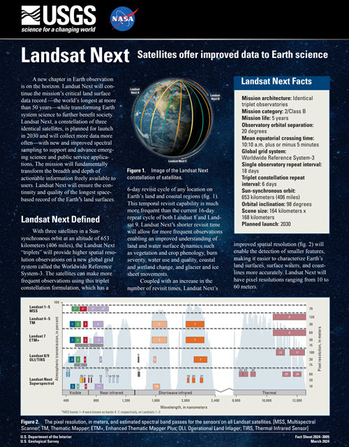
Landsat Next Fact Sheet
The USGS has released the Landsat Next Factsheet. Landsat Next will ensure the continued continuity of the Landsat program and is expected to launch in 2030. Learn more about Landsat Next from here: https://pubs.usgs.gov/fs/2024/3005/fs20243005.pdf
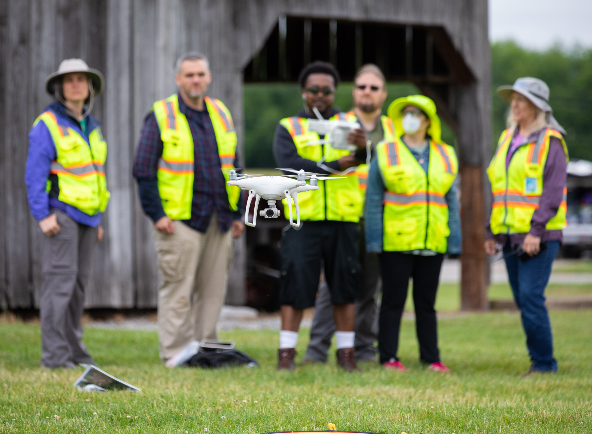
New Drone Workshops!
New Workshops for 2024! We are offering a couple of new workshop options for 2024! Come learn about the workflows associated with generating maps from drones at the 3-day, face-to-face Mapping with Drones: Drone


Our most popular resources
Our Mission
VirginiaView (VAView) is a full member of AmericaView, a nationwide consortium of remote sensing scientists and educators. VAView was established sometime around 2003, and continues to be based at Virginia Tech’s College of Natural Resources and Environment. Since 2003, VAView’s programming has changed to accommodate changes in technology and changing priorities in industry and educational needs, VAView’s mission remains constant.
Through its programming, VAView facilitates remote sensing and related geospatial education and workforce development in support of Virginia’s communities. This mission is supported through the development of new educational resources (including ebooks, hardback books, short tutorial documents, and video tutorials), face-to-face workshops, classroom presentations / demonstrations, online workshops, and webinars. VAView has a long history of working with public, private, and non-profit organizations, middle / high school / community college / 4-year college communities. Through its partnership with Virginia Cooperative Extension, VAView is able to extend programming to an array of stakeholders that reach across the Commonwealth.


Our Partners
Consortium Member Institutions and Organizations