Landsat Lens is a user-friendly online application that provides students with the ability to explore changes on the Earth’s surface due to natural or human causes. Imagery is seamlessly integrated with the online app (think user friendly!). Select an area of the world (interesting examples are already bookmarked) and different years to explore changes. What has caused these changes, and how might these changes impact the broader environment?
The Landsat Explorer is similar to the Landsat Lens (above) but is more robust. Students can navigate to any location on the earth, and explore changes over time (the archive goes back to the 1970’s) and space. This is a great way for students to learn more about change detection, develop experience using spectral bands, understand image resolution, etc. Students can compare imagery dates using the swipe tool, and they compare spectral signatures over space and time. Imagery is seamlessly integrated with the online app (think user friendly!). A help manual is available online. Where are the changes in the landscape, what kinds of transformations can you identify (rural –> urban?) and what are the causes of these changes, and other environment issues might these changes impact?
AmericaView’s Earth Observation Day Website (educational resources for remote sensing)
The AmericaView Consortium is pleased to announce Earth Observation Day (EO Day) Website (http://www.earthobservationday.com). AmericaView (AV) is a nationwide program that focuses on public domain remote sensing data and geospatial technology in support of applied research, K-16 education, workforce development, and technology transfer. While Earth Observation Day is held on March 24th, resources can be accessed and integrated at anytime! This is a comprehensive Website, directed to support the needs of the educational community. The website provides access to an array of resources, including: Earth Observation Day Lesson Plans (tailored for elementary, middle, high school, and higher edu.); Satellite map posters of each state (and, yes, there is a Virginia poster available for download!); Remote sensing tutorials and lesson plans; Access to remote sensing data; Satellite images; and more!
Virginia Geographic Alliance (VGA) Workshop Materials
- Weather Underground – step by step instructions
- GoogleMyMaps
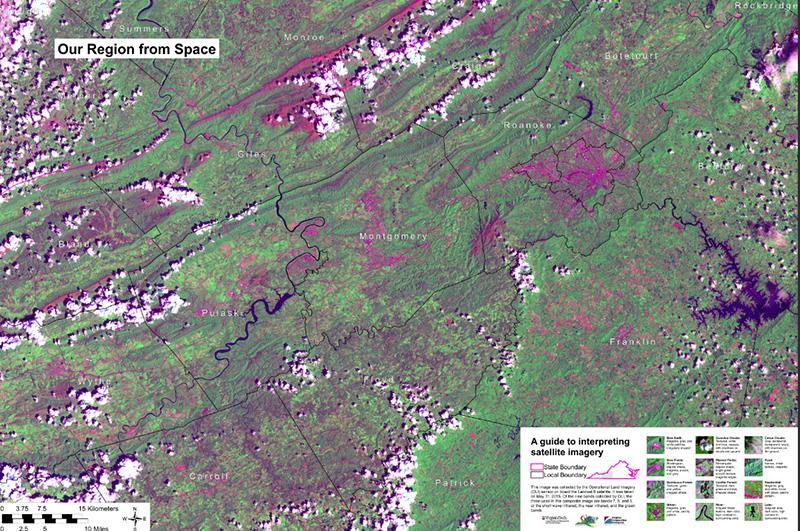
- Virginia Landsat Poster (36″x48″ | Be patient with the download, this is ~100 MB)
The Geospatial Revolution Project (awareness video)
The Geospatial Revolution Project (http://geospatialrevolution.psu.edu/), developed by Penn State Public Broadcasting, has an integrated public media and outreach initiative focused upon the world of digital mapping and how it is shapes the way our society functions. The project features a web-based serial release of several video episodes, each focused upon an specific narrative illuminating the role of geospatial knowledge in our world. These episodes will combine to form a full-length documentary. The project also will include an outreach initiative in collaboration with partner organizations, a chaptered program DVD, and downloadable outreach materials. The five-minute trailer available at the web site provides an especially effective introduction to geospatial data.
Spatial Data Science in Higher Education (Esri) (educational resources for remote sensing)
Esri’s spatial data science educational portal provides access to tools, teaching materials, learning lessons, scripting tools, and examples and descriptions of geospatial artificial intelligence (GeoAI). Subscribe and receive updates.
American Society for Photogrammetry and Remote Sensing (ASPRS) (awareness video)
American Society for Photogrammetry and Remote Sensing (http://www.asprs.org/) has produced a series of short videos (each about 2 minutes or less in length). The link to “ASPRS films” (under the “Education & Professional Development” tab) (http://www.asprs.org/films/index.html) connects to a series of short videos highlighting topics relating to ASPR history and its contributions to the fields of photogrammetry and remote sensing. Videos in this series that are especially relevant include:Aerial Survey Pioneers; Geospatial Intelligence in WWII; Role of Women Photogrammetry in Space Exploration; Evolution of Analog to Digital Mapping
Note: These videos are also posted to www.youtube.com/user/ASPRS, in versions that have lower visual quality
The British Broadcasting Corporation project (awareness video)
Britain From Above, has multiple short video units (usually about 3 to 5 minutes each). At: http://www.bbc.co.uk/britainfromabove/, go to “See Your World from Above” (“Browse stories“), then “Stories Overview.” Then from ”Stories Overview,” select the “Secrets” tab, and play the “The Dudley Stamp Maps.” Or, from the ”Stories Overview” section, select the “Behind the Scenes,” tab, then play the “Archive.” There are many other videos of interest at this site.
USGS National Land Cover Data (NLCD) for Virginia
- The USGS provides Statewide Seamless (Virginia) NLCD data . Access this data here: http://landcover.usgs.gov/show_data.php?code=VA&state=Virginia
- The UVA Geostat Center provides images of NLCD data by county, along with a legend and statistics for each county. Access these images here: http://fisher.lib.virginia.edu/collections/gis/nlcd/browse_county.html
Earth Resources Observation and Science (EROS) Center Image Gallery
- The EROS Data Center Landsat Change Quiz
- The EROS Image Gallery includes Earth as Art images, statewide Landsat images, statewide NED images, and the Lewis and Clark Expedition, as seen from space! Every image tells an interesting story. Access these collections here: http://eros.usgs.gov/imagegallery/.
60 wonderful Landsat 7 Images of the Earth: http://www.webdesignerdepot.com/2009/08/60-stunning-satellite-photos-of-earth
Want to learn more about remote sensing? Check out NASA’s Remote Sensing Tutorial: http://rst.gsfc.nasa.gov/

