Workshop Opportunities and Other Events
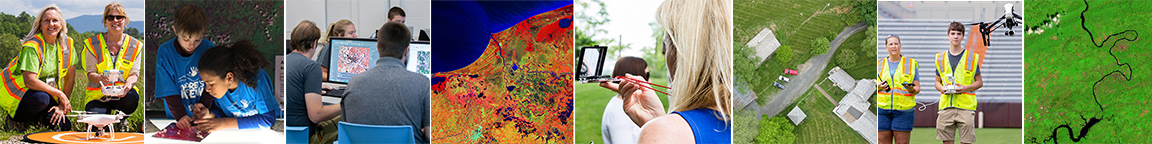
ADVANCE – Professional Development Program for HS Teachers and 2-year College Faculty: The program An Experiential and Data-driven Approach to Agricultural Education (ADVANCE) is a face-to-face professional workforce development opportunity that provides educators with the knowledge, experience, curriculum resources, supplies/equipment, and mentoring to support the implementation of drones and precision agriculture concepts in the classroom. This is a hands-on, field-based workshop. Additional information and registration about the workshop is available from here: www.vtadvance.net
Mapping with Drones: Drone Discovery: If you want to collect data and learn how to make maps with drones, then this 3-day, face-to-face, and hands-on workshop is for you. This introductory workshop provides an overview of the workflows and duties associated with drone operations. Participants will gain experience with flight planning, quadcopter (and fixed-wing) flight operations, applicable software, data (image) acquisition, image processing, and image analysis. Additional information about the workshop is available here: https://virginiaview.cnre.vt.edu/mapping-with-drones-workshop-flight-planning-flight-operation/ | Date: May 20-22, 2024
Remote Pilot Certification Test: This is an intensive yet introductory level, 2-day virtual professional development workshop. No previous knowledge or experience with drones, sUAS, or GIS is required. This workshop is appropriate for educators (including Extension, MS, HS, 2-year, and 4-year), the private sector, and local/state/federal government employees interested in learning more about small uncrewed aircraft systems (sUAS) and drone regulations. This workshop prepares participants for the FAA remote pilot test (aka Part 107). Additional information about the workshop is available from here: https://virginiaview.cnre.vt.edu/workshops-events/ | Date: Several options
The Virginia Tech Office of GIS and Remote Sensing (OGIS) Research Symposium: Let’s celebrate Earth Observation Day! The 2024 Virginia Tech Office of GIS and Remote Sensing (OGIS) Symposium will be held virtually this spring on April 5, 2024. We will kick off each OGIS Symposium with an engaging keynote presentation (guest speaker announcements are forthcoming), followed by the Student Poster / Web Map App showcase and competition. Cash prizes (sponsored by VirginiaView) will be awarded! The call for student poster & web map app abstracts (UG and Grad) is now open. More info here: https://virginiaview.cnre.vt.edu/virginia-tech-ogis-symposium/
The GeoTEd-UAS Institute: This workforce development program, funded through the National Science Foundation ATE program and in partnership with Germanna CC, Thomas Nelson CC, the Virginia Space Grant Consortium, and Virginia Tech Geospatial Extension Program, is appropriate for community college faculty, high school teachers and 4-H leaders. Last year’s cohort was the week of May 21st, 2023. We continue to pursue funding opportunities to support new opportunities.